INDONESIA HYDRO™ GEOSURVEY provides geological investigation and topographic survey services across every stage of infrastructure development—including buildings, roads, and hydropower. Our experience, resources, datasets, and research—supported by professional-grade hardware and software—enable outputs that are fast, accurate, optimized, comprehensive, and cost‑efficient.
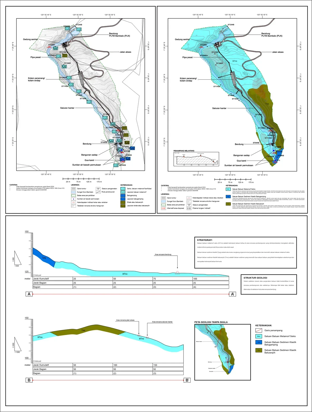
Geomorphology, rock distribution & stratigraphy, structural mapping, landslide potential; outputs include geological maps and cross‑sections.
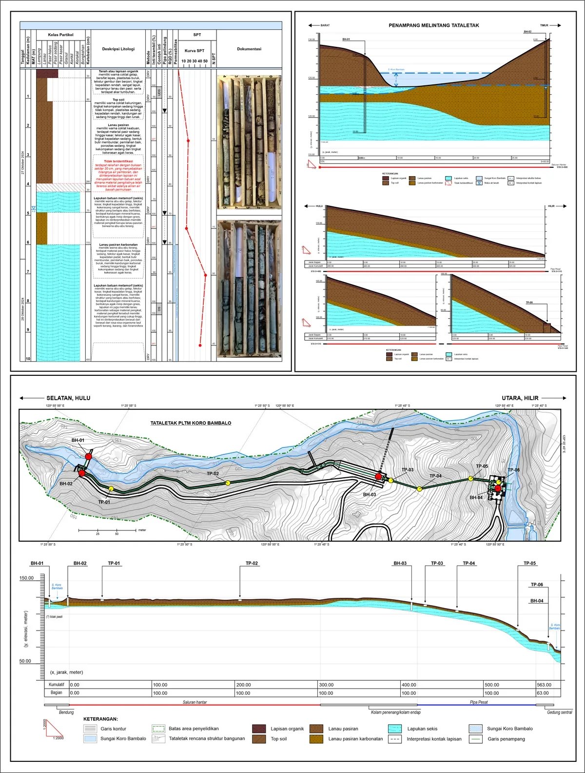
Hydraulic rotary coring; SPT, disturbed/undisturbed sampling; permeability tests; test pits; drill logs and cross‑sections.
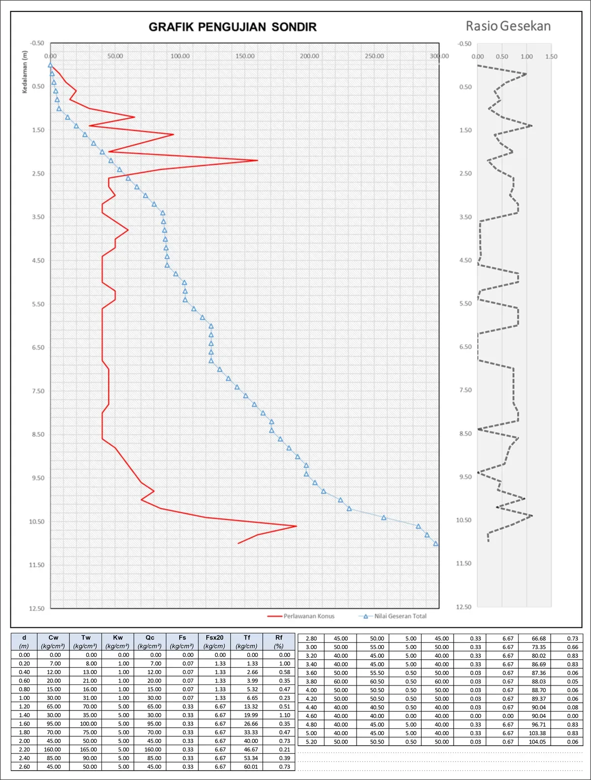
Determination of qc, fs, Rf parameters and allowable bearing capacities supporting foundation design.
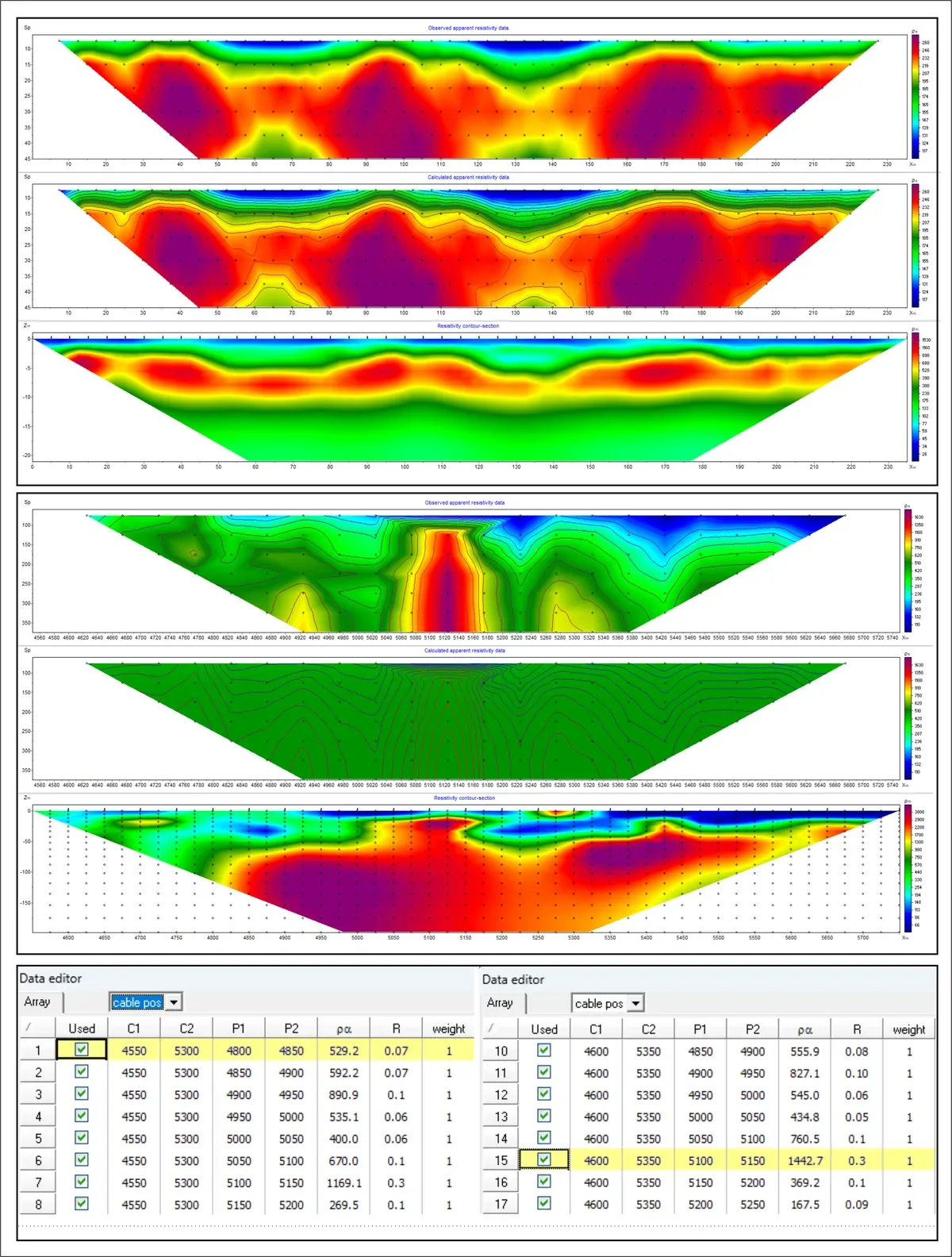
Resistivity, IP, and SP surveys for subsurface characterization, hazard mapping, and exploration support.
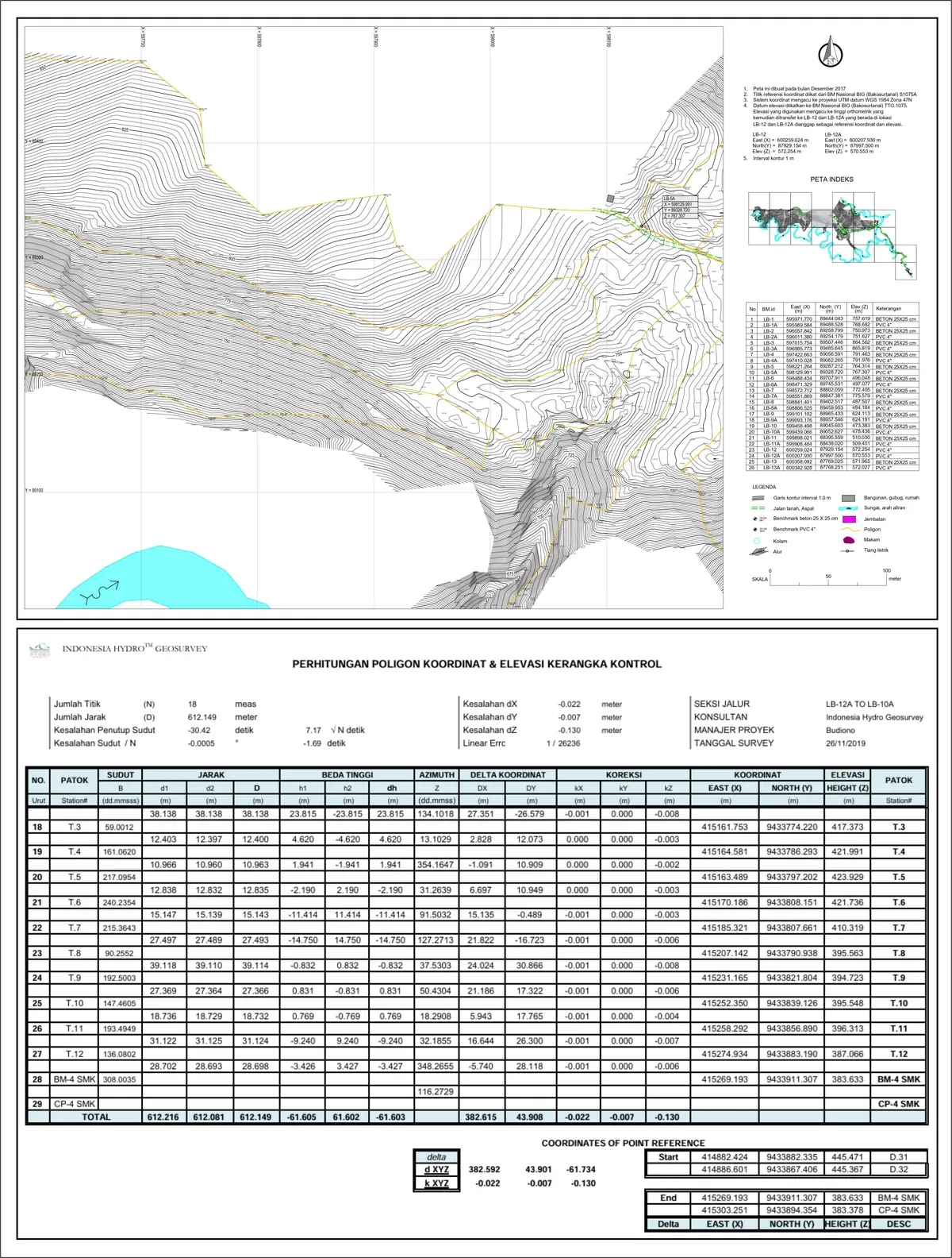
Benchmark establishment, control networks, leveling, detailed terrestrial surveys, data processing, and drawing.
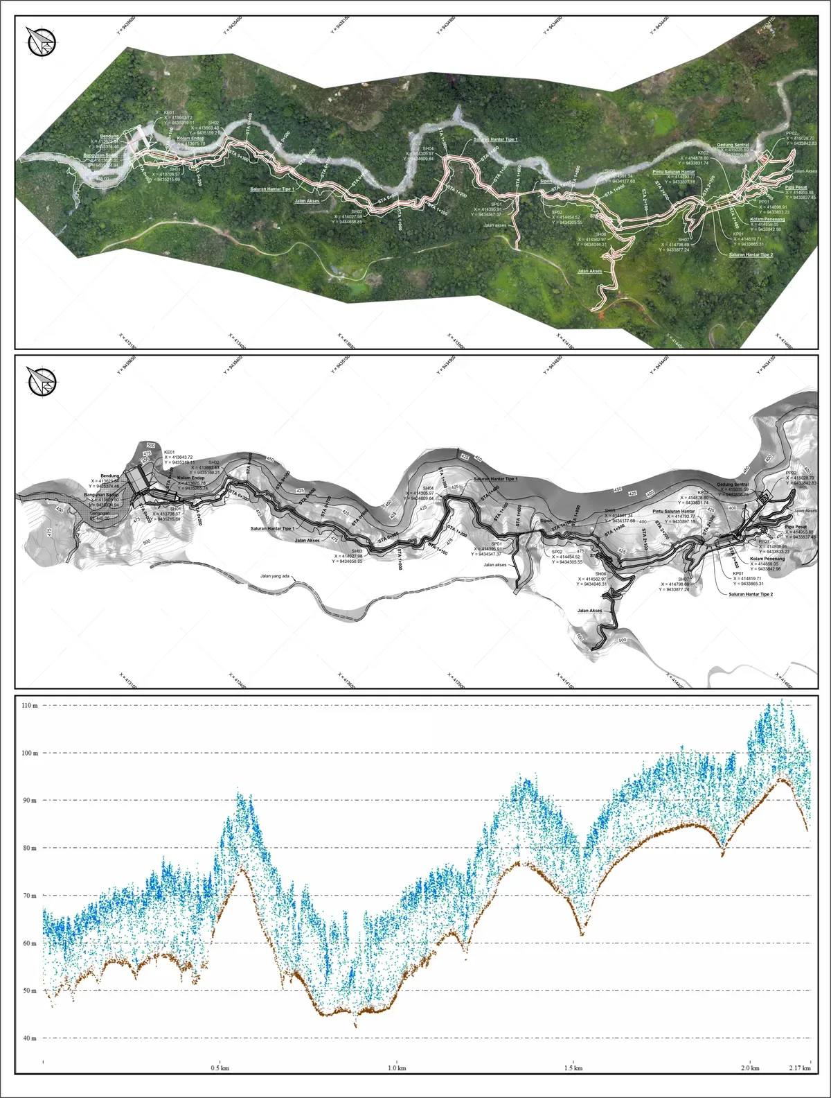
Orthomosaic imagery, digital terrain models, contouring, and cross‑sections for rapid large‑area mapping.